-40%
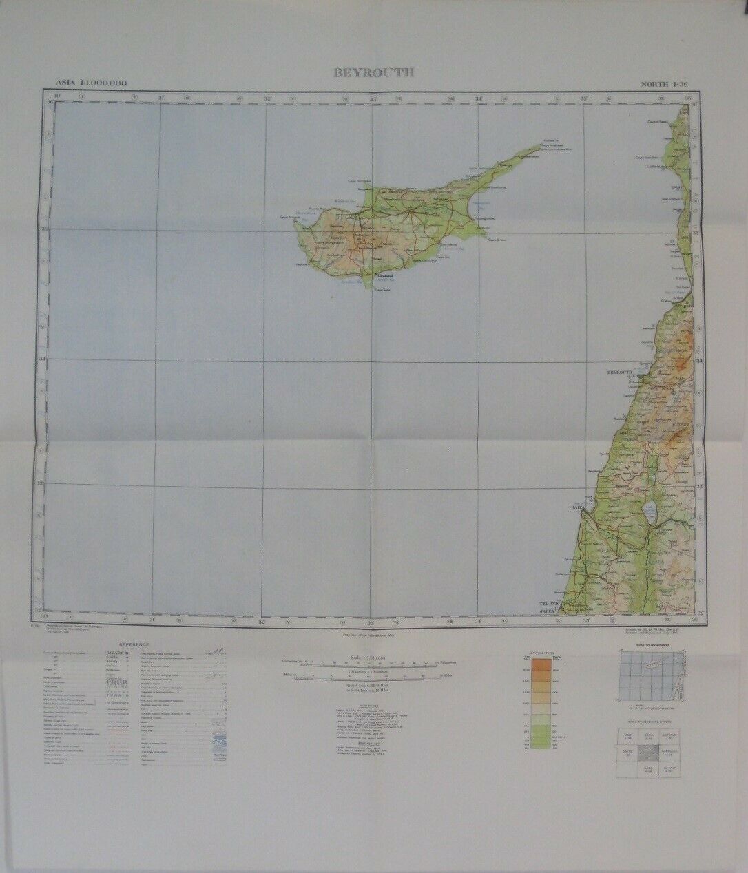
1941 War Office Map CYPRUS Eastern Mediterranean Beirut Tel Aviv Haifa Limassol
$ 15.83
- Description
- Size Guide
Description
Large-format color lithographed map of part of the eastern Mediterranean, printed by the War Office, London, in 1941.The map is drawn on a scale of 1:1,000,000 and locates cities, towns, railroads, motor roads, telegraph lines, political boundaries, and natural features, with topography drawn in relief.
The coverage area is bounded by longitude
30°00' E
to
36°00' E
and latitude
32°00' N
to
36°00' N.
The map was compiled by the British War Office, London, and printed in July 1941 as a revision of the 1939 edition. It is titled
Beyrouth
and is identified in the upper corner as North I-36.
Among the named places and features are Cyprus, Tripoli, Nablus, Lake Tiberias, Zahle, Saida, Jaffa, Acre, Nazareth, Tel Aviv, Haifa, Ktima, Nicosia, and Limassol.
Condition:
This map is in
excellent condition,
bright and clean, with
no
marks, rips, or tears. It folds to approximately 6¾" x 7½" and is blank on the back, with no printing on the reverse side. Please see the scans and feel free to ask any questions.
Buy with confidence! We are always happy to combine shipping on the purchase of multiple items — just make sure to pay for everything at one time, not individually.
Powered by SixBit's eCommerce Solution
