-40%
Historical Old City Map JERUSALEM Israel West Bank Palestine Mosques Churches
$ 5.27
- Description
- Size Guide
Description
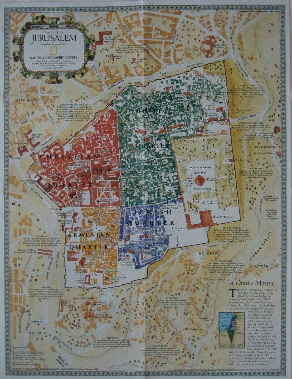
Handsome, color lithographed fold-out map of the old city of Jerusalem.This map opens to 51.5 x 40 cm [20¼" x 15¾"] and has a decorative title cartouche and attractive border.
It locates the Temple Mount and the four ancient quarters of the city: Muslim, Jewish, Armenian, and Christian.
There are historical notes explaining labeled features on the map, and among the named places are Mount Zion, Gethsemane, Morasha, Pool of Siloam, Wailing Wall, City of David, Dung Gate, Church of the Holy Sepulchre, Via Dolarosa, Indian Hospice, Monastery of the Flagellation, Habad Synagogue, Damascus Gate, and many more.
On the reverse side there is a map of present-day Jerusalem and vicinity, drawn on a scale of 1:84,840, showing roads, ruins, Jewish settlements, and refugee camps. Four insets show the city's history, from the First Temple Period to the Crusades.
This map was published by the National Geographic Society in April 1996 and is dated in the legend.
Condition:
It is in
excellent condition,
bright and clean, with
no
marks, rips or tears. Please see the scans and feel free to ask any questions.
Buy with confidence! We are always happy to combine shipping on the purchase of multiple items — just make sure to pay for everything at one time, not individually.
Powered by SixBit's eCommerce Solution
